Survey in the field. Work in the office at the same time.
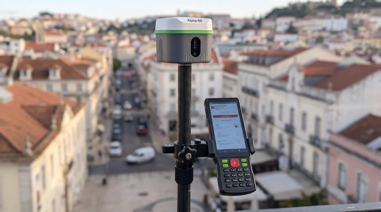
The Alpha 40 with the GeoMarco Sync app sends every point to QGIS in the office, with its code, RTK quality and photo, while the crew is still in the field. No file exports, no emails and no subscription.
- Sold and supported in Portugal by Map3Dpro
- On-site training and setup included
- Technical support in Portuguese
For people who need to measure well and decide fast
BUPi technicians, solicitors and lawyers
Accurately surveyed boundaries and a photo of every boundary mark, for the georeferenced plan and for meetings with landowners. (BUPi is Portugal's simplified land registry for rural properties.)
Valuers and experts, for courts and insurers
Areas of remaining parcels, boundary encroachments and claim areas, with a photo record of every point.
Surveyors and geomatics engineers
More points per day, with a tilted pole and the laser for places you cannot reach.
Site supervision and construction management
Checking as-builts, setting-out, trenches and structures before work moves on.
Agricultural, forestry and environmental technicians
Vineyards, orchards, irrigation networks and area boundaries, with points already sorted by code.
Municipalities and infrastructure managers
Inventories of roads, sewers, street lighting and street furniture.
Today, the survey only reaches the office at the end of the day
| Today | With the Alpha 40 and GeoMarco Sync |
|---|---|
| The surveyor goes back to the office, exports the file and emails it. | Points reach the company Drive while the crew is still surveying. |
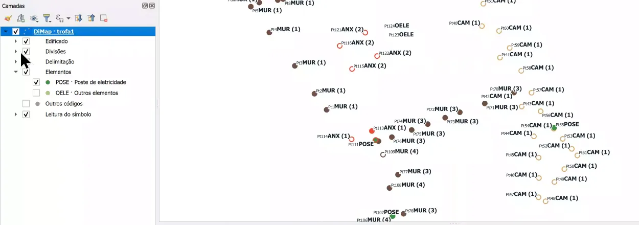
| In the office, someone imports the points, codes them again and matches the photos by hand. | In QGIS, points appear with their code colour, RTK quality and photo. |
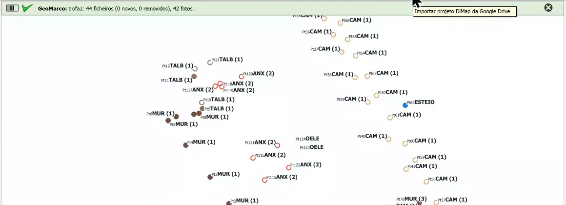
| A missing vertex or a wrong code is only found later, and means going back to the site. | The office watches the survey grow and can ask for a correction by phone before the crew leaves the site. |
Fewer trips, fewer transcription errors, and drafting starts the same day.
Four reasons for the Alpha 40
Survey with a tilted pole
The problemWith the pole held vertical, building corners under eaves, the foot of an overgrown wall or a point next to a parked car are hard or impossible to measure.
The solutionTilt compensation (IMU) corrects the position up to 60° of tilt, with no initialisation: just take a few steps. The surveyor measures without wasting time on the bubble.
Measure at a distance with the laser
The problemThe centreline of a busy road, the crest of an embankment or a boundary mark across a stream force the surveyor into dangerous or unreachable places.
The solutionThe built-in laser, with a calibrated optical sight, measures points up to 50 m away without going there, with 3 to 5 cm at 10 m. The surveyor stays in a safe place.
A photo linked to every point
The problemA list of coordinates with codes such as "TREE" or "MARK" does not show what was measured, and in a meeting with landowners a dot on a map is not very convincing.
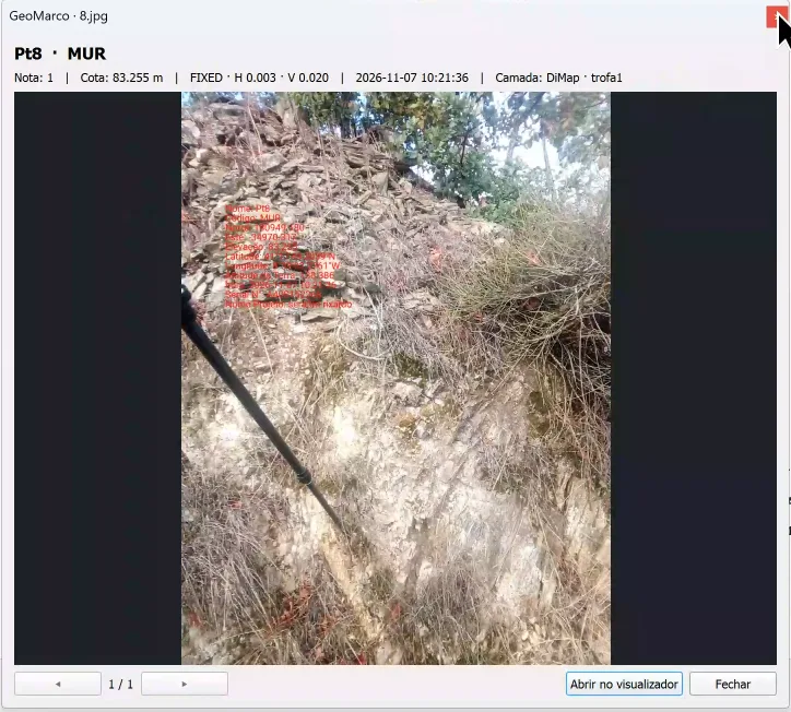
The solutionThe photo taken in DiMap Pro is linked to the point. In QGIS, clicking the point shows the photo, the precision and the FIXED or FLOAT status. The office gets the point and the image of the mark, manhole or wall it came from.
Field and office connected, no subscription
The problemMany solutions charge a yearly fee to sync data between the field and the office.
The solutionThe GeoMarco Sync app and the QGIS plugin are included with the Alpha 40, with no monthly fees and no per-user licences.
In the field
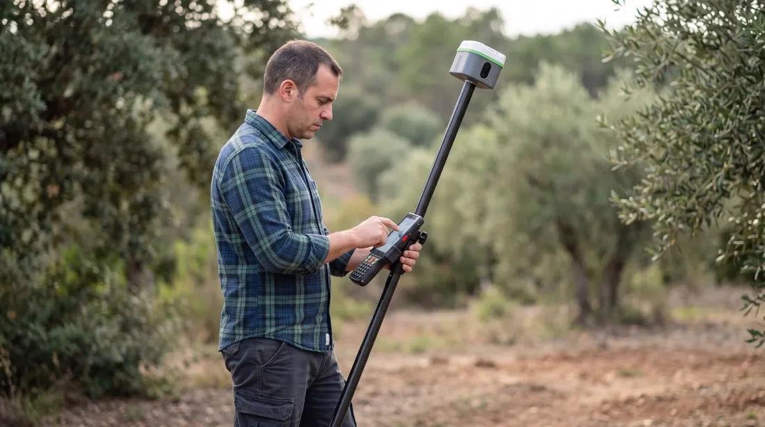
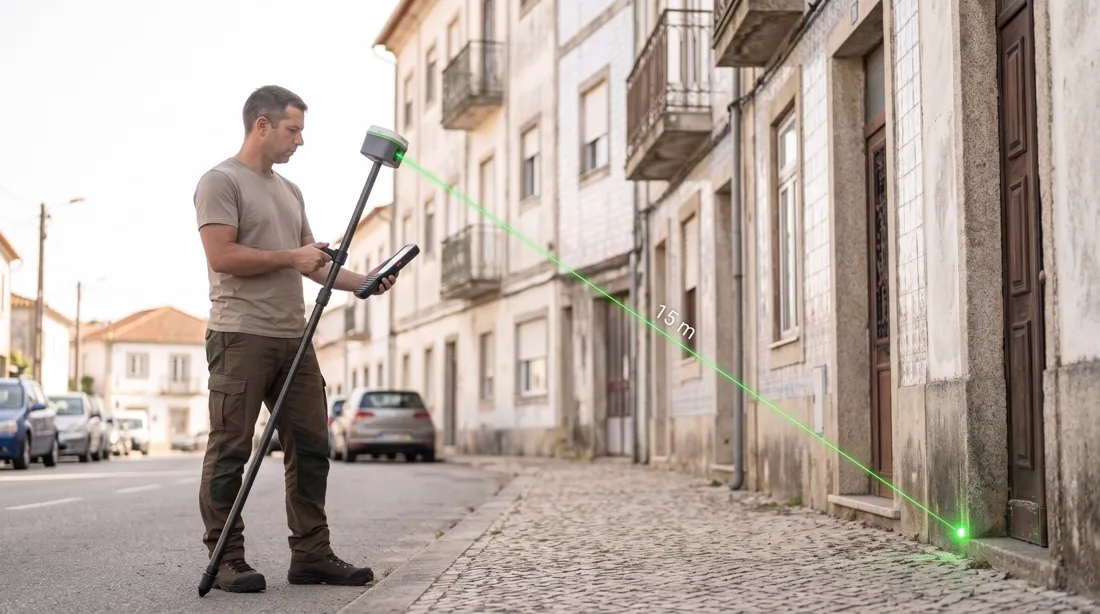
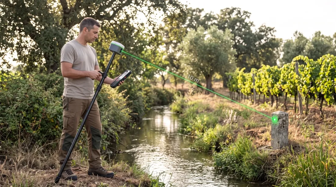
Illustrative images.
How much you save over 3 years
Sync without yearly fees
| Per year | Over 3 years | |
|---|---|---|
| Subscription-based sync (typical market prices) | €250 to €1,000 | €750 to €3,000 |
| GeoMarco Sync with the Alpha 40 | €0 | €0 |
Prices per device, based on a review of several manufacturers' prices carried out in November 2026.
Sending uses the controller's mobile data or Wi-Fi, and RTK correction uses the network or base you already use. These costs do not change with GeoMarco Sync.
In QGIS, ready to work
Points arrive organised. The plugin menus are in Portuguese.
How it works
Data always flows one way, from the field to the office. The app only reads DiMap Pro projects and never changes anything on the controller.
- 1/4
Measure in DiMap Pro
The crew works as usual: points, codes and photos on the Alpha 40 controller.
- 2/4
The app sends what changed
With field mode on, GeoMarco Sync detects new points and uploads them every 30, 60 or 120 seconds. Outside field mode, it uploads about every 15 minutes. With no signal, it queues them.
- 3/4
It lands in your Google Drive
Projects stay in the company's own Google account, in a GeoMarco folder. They never go through our servers.
- 4/4
Open it in QGIS
The GeoMarco plugin loads the points in PT-TM06 with code, precision, FIXED or FLOAT status and the photo of each point.
Watch a real survey
From DiMap Pro to QGIS, with the GeoMarco Sync app in between (English captions, 1 min 19 s).
Arrives ready to work
- Alpha 40 GNSS receiver with IMU and laser
- Android controller with DiMap Pro
- Carbon pole
- Carrying case
- GeoMarco Sync app with the activation key
- Initial setup of the equipment and the app, delivered ready to use
- On-site training for your team, in Braga or at another agreed location
- Technical support in Portuguese
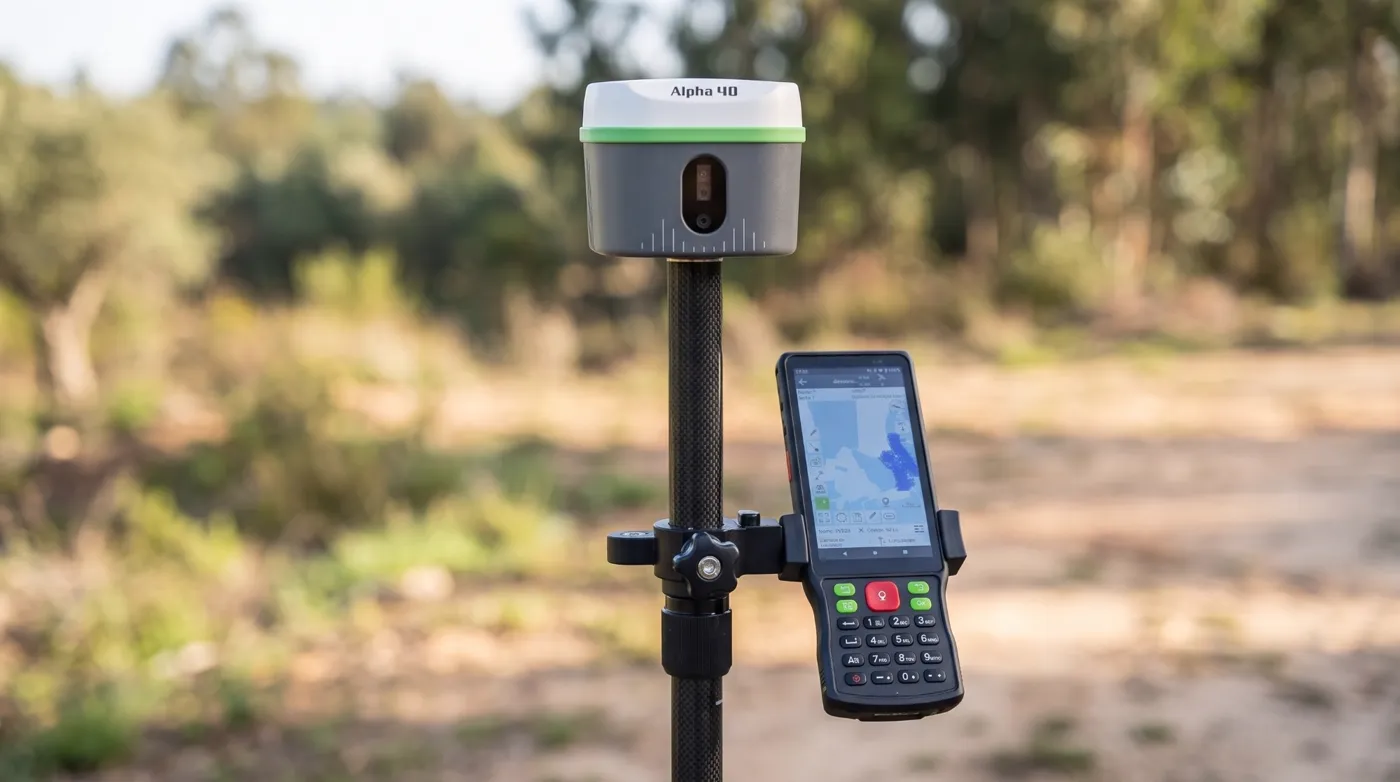
Illustrative images.
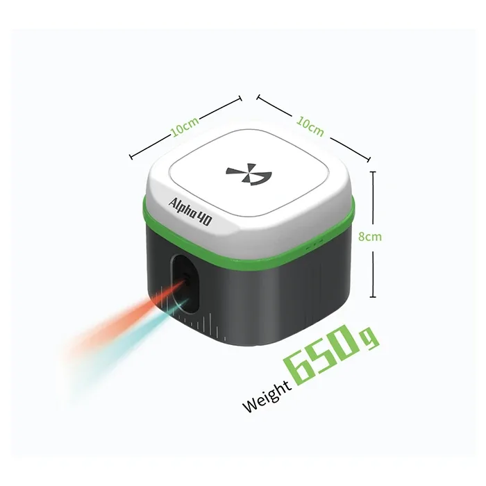
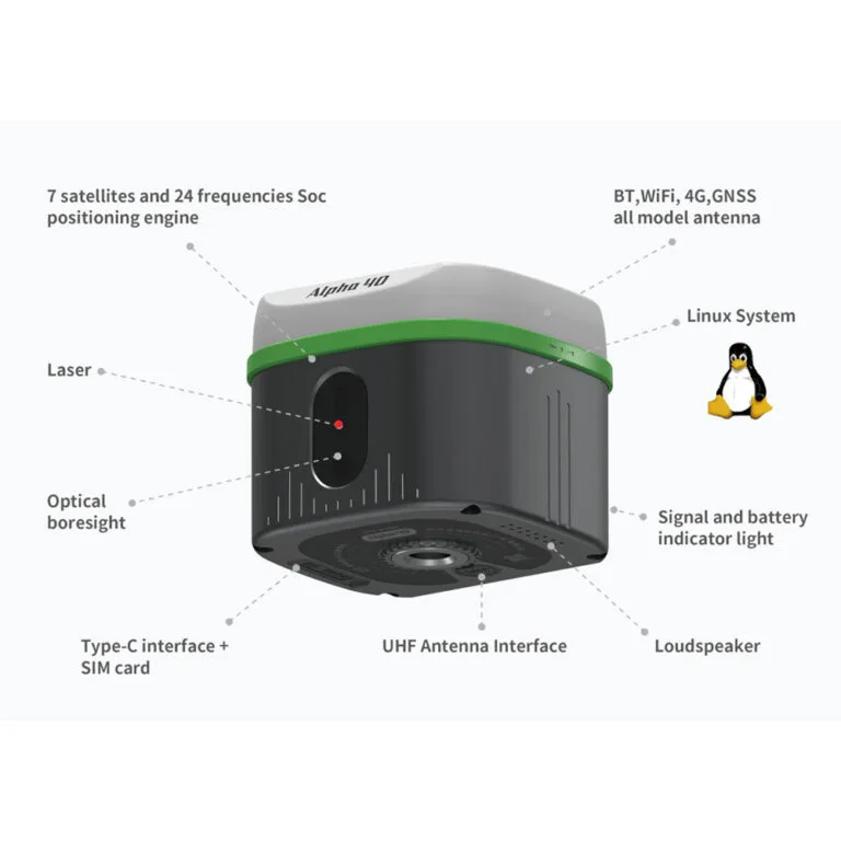
Alpha 40 with DiMap Pro
GNSS RTK receiver with IMU, laser and cameras for augmented-reality stakeout. Sold and supported in Portugal by Map3Dpro.
| Signals | 1408 channels: GPS, GLONASS, Galileo (incl. E6), BeiDou (incl. B2b), QZSS, NavIC |
|---|---|
| RTK accuracy | H ±(8 mm + 1 ppm) · V ±(15 mm + 1 ppm) |
| Tilt | 0.015° IMU, compensation up to 60°, ±(8 mm + 0.3 mm/°), no initialisation |
| Laser | 50 m range (rangefinder ±1 mm); point at 10 m within 3 to 5 cm |
| Communications | 4G, 2 W UHF radio, Wi-Fi, Bluetooth 5.2 |
| Battery | 37 Wh, up to 18 h on NTRIP |
| Ruggedness | IP67, 1.8 m drop, −30 °C to +70 °C, 650 g, 10 × 10 × 8 cm |
| Controller | 5.5" Android with DiMap Pro |
Install
The GeoMarco Sync app is delivered and set up with every Alpha 40, activation key included. The QGIS plugin can be downloaded here, and the instructions are on the help page.
GeoMarco Sync app
For the Alpha 40 controller (Android 8 or later, with a Google account). On first use you choose the language, accept the terms, enter the activation key, connect the Google account and pick the DiMap Pro projects folder. Then the app does the rest.
Request a demoGeoMarco plugin for QGIS
For QGIS 3.22 or later. Sign in with the same Google account and load projects in one click. Colours by code, photos and RTK quality on the map.
Frequently asked questions
Do I need to buy anything else?
Not to start surveying. The Alpha 40 comes with the controller, pole, case and the GeoMarco Sync app set up. You need a Google account for the Drive, and mobile data or a base station for RTK correction, as with any GNSS receiver.
Does the GeoMarco Sync app cost anything?
No. The app and the plugin are included with the Alpha 40, with no monthly fees and no per-user licences. A free Google account includes 15 GB, enough for many surveys with photos.
Does it work with the receiver I already have?
No. GeoMarco Sync is made for the Alpha 40 with DiMap Pro software.
How do I get the activation key?
The key comes with the Alpha 40 and the app is delivered already activated. It has 16 letters and is checked on the controller itself, with no network needed.
Where is my data stored?
In your own Google Drive, in a GeoMarco folder created by the app. Data goes from the controller to the Drive and from the Drive to QGIS, without passing through GeoMarco servers. The app can only access the files it creates itself.
What if there is no network in the field?
Points are queued on the controller and sent when the connection returns. Nothing is lost, and photos can wait for Wi-Fi.
Does the office see the points instantly?
Almost. With field mode on, the app sends new points every 30, 60 or 120 seconds. In QGIS, one click on the update button (Atualizar camadas DiMap) brings in what has arrived. With a good connection, the point is in the Drive in under two minutes.
Can I edit the points in QGIS?
The synced layer is read-only, because it is replaced on every update. To work on the data, save a copy as a GeoPackage and draw polygons snapped to the points.
Which computers does the plugin run on?
QGIS 3.22 or later, on Windows, macOS or Linux.
See the Alpha 40 working with your own data
We arrange an on-site demo, in Braga or at another agreed location, or by video call. Leave your details and we will reply on the next working day.
Alternatively:
geral@map3dpro.pt